
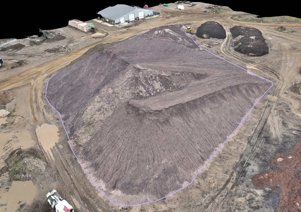
Know exactly how much material is on the ground.
AGGREGATE & STOCKPILE
Recurring drone stockpile volume surveys for quarries, asphalt plants, recycling yards, and topsoil and mulch suppliers — accurate inventory numbers for reporting, reclamation, and planning, on whatever schedule your operation runs on.
-
FAA Part 107 Licensed
Fully insured drone operations
-
Southwest Michigan Based
On site fast, no long travel days
-
Recurring Flights Available
Monthly, quarterly, or on your schedule
-
Fast Turnaround
Volume reports delivered quickly
Stockpile inventory is one of the clearest, most repeatable uses for drone mapping — a single flight over a yard produces a volumetric measurement you can use for inventory reporting, reclamation planning, or year-end numbers. Because it's the same site flown on a schedule, this is naturally a recurring service, not a one-time project.
WHAT WE OFFER
Built for ongoing inventory reporting
Stockpile Volume Surveys
Drone mapping converted into accurate volumetric measurements for each pile on your yard, delivered as a report you can use for inventory or reclamation reporting.
Recurring Flight Programs
Monthly, quarterly, or custom-schedule flights so your inventory numbers stay current without you having to remember to book it.
Drone Mapping & Orthomosaic Surveys
A full top-down map of the yard from a single flight, useful for planning and layout beyond just volume.
Site & Aerial Photography
Aerial photos of the yard for marketing, reporting, or sharing with stakeholders.
Drone LiDAR Surveying
Higher-precision point cloud data for sites where mapping accuracy needs to be tighter.
Multi-Site Programs
Consistent survey methodology across multiple yards or locations, so numbers are comparable site to site.
Frequently Asked Questions
-
It depends on how fast your inventory turns over — monthly and quarterly are both common. Tell us how your operation runs and we'll recommend a schedule.
-
Accuracy depends on the flight plan and any ground control used. Tell us what the numbers need to support (internal reporting vs. reclamation filings) and we'll recommend the right approach.
-
Yes — recurring multi-site programs are a common setup, with consistent methodology so the numbers are comparable across locations.
-
We deliver a volumetric report for each survey. Let us know what your filing requires and we'll make sure the report supports it.
-
Yes, drone flights don't require pausing yard operations in most cases — we'll coordinate timing with your site.
Get an accurate number on your stockpiles, on a schedule that works for you.
Request A Quote
Tell us about your project and hear back within the hour.