
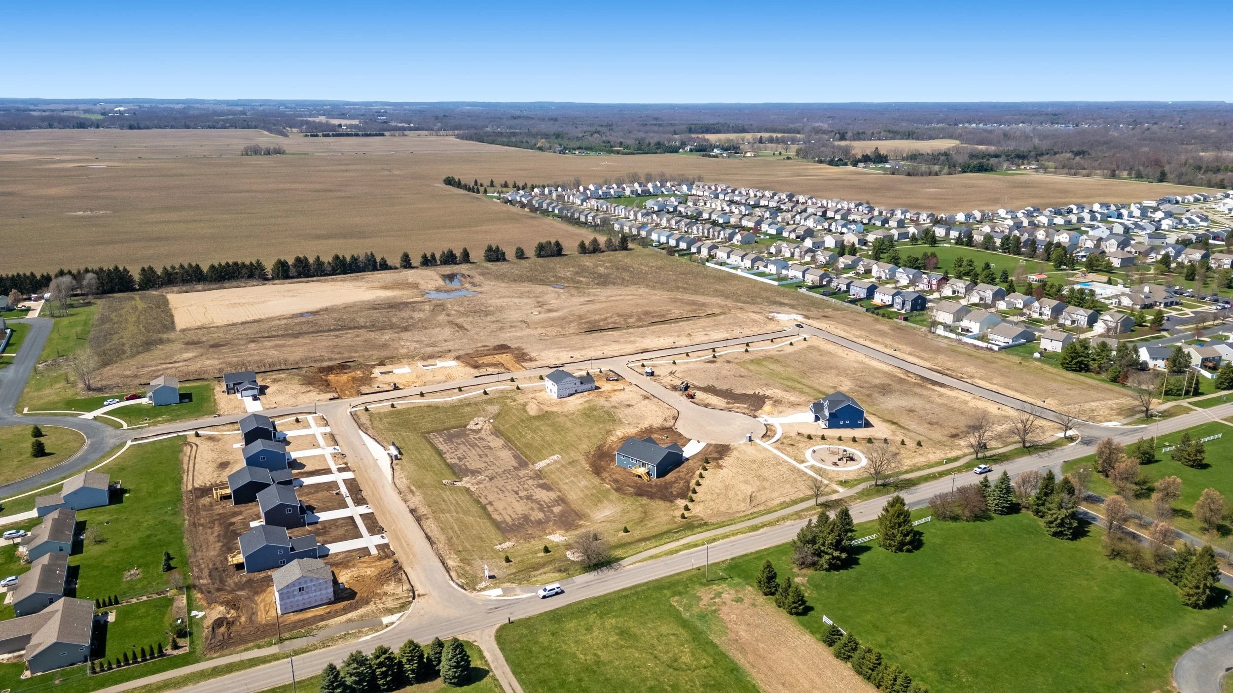
Survey-grade drone LiDAR, on site within one week. Nationwide.
Topographic data for the sites that are slow, wooded, or risky to walk. We capture drone LiDAR with FAA Part 107 licensed, insured pilots, process it into a clean, classified point cloud you can drop straight into your workflow, and we move fast. For most projects we are on site within one week of your notice, anywhere in the country. You get a real date and a point of contact, not a ticket in a queue.
-
RTK / PPK
Accuracy
-
Licensed Pilots
FAA Part 107, insured
-
Within One Week
On site after your notice
-
Nationwide
Coverage
-
Classified Point Cloud
Cleaned and ready to use
WHY TEAMS PICK US
On site within a week. You're on a schedule, not in a queue.
Civil engineers tell us the same thing: they sometimes wait weeks for survey data, with no firm date, while the whole project sits on it. That will never happen with us.
We work the other way. When you sign, we commit to getting on your site within one week, and you get a real date and a person who owns the job from quote to delivery. Two weeks is the survey standard. One week is the difference, and it is the whole point when the data is the thing holding up the project.
DRONE MAPPING
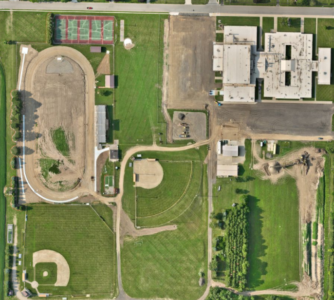
Mapped and modeled from above
Standard aerial photography, stitched into a measurable orthomosaic and 3D model of your site — built for open, cleared, or already-graded ground, and available from the same flight day as LiDAR when a project needs both.
LiDAR or drone mapping — which fits your site?
Both come off the same flight day. Which one you actually need comes down to what's covering the ground.
| Drone LiDAR | Drone Mapping | |
|---|---|---|
| Ground visibility | Sees through canopy to bare earth | Needs a clear view of the ground |
| Best for | Wooded, rough, or hard-access terrain | Open, cleared, or already-graded sites |
| Capture method | Laser pulses, classified point returns | Overlapping aerial photos, stitched |
| Typical deliverable | Classified point cloud, bare-earth DEM | Orthomosaic, 3D model, volumetrics |
| Not sure which you need? | Send us the site and what you're trying to get out of it — we'll tell you which one fits, or if the job calls for both. | |
THE SWEET SPOT
Built for the sites that are hard to walk
Drone LiDAR earns its keep on ground that is slow, dangerous, or expensive to survey on foot. The clearest win is wooded or hard-access terrain, roughly 20 to 30 acres and up, where a ground crew would spend days fighting brush and line of sight.
LiDAR pulses find the ground through tree and vegetation cover, so you get a real bare-earth surface where photogrammetry alone cannot see. You cover the acreage in a single flight instead of a week of field work, nobody is climbing slopes or crossing active ground. The bigger and rougher the site, the more it saves you in time and field effort. For tight, open, building-scale work our terrestrial 3D scanning is still the better tool. For large, vegetated, or awkward sites, this is the one.
How it compares to a traditional ground survey
| Drone LiDAR | Traditional ground survey | |
|---|---|---|
| Large wooded / rough sites | Hours in the air, one mobilization | Days of field crew, slow going |
| Seeing through vegetation | Ground points through tree cover | Limited by line of sight |
| Safety | Crew stays clear of slopes and hazards | People on foot across rough terrain |
| Point density | Millions of measured points | Spot shots at chosen locations |
| Efficiency at scale | More efficient as the site grows | Slower and harder as the site grows |
| Best for | 20 to 30+ wooded or hard-access acres | Small, open, or high-precision boundary work |
What We Deliver
Standard deliverables
- ✓Cleaned, classified point cloud, ready to use
- ✓LAS / LAZ point cloud files
- ✓Orthomosaic (high-resolution top-down image)
- ✓DEM (bare-earth digital elevation model)
- ✓3D model of the site
- ✓Free ground-level photos, included as a value-add
THE COMBO
LiDAR, mapping, and photography in the same trip
We are not a single-trick LiDAR shop. While we are capturing your site we can also deliver drone mapping (orthomosaics and measurable site maps) and high-resolution photo and video. That means one mobilization can hand you the terrain data, the measurable map, and clean marketing or documentation imagery, instead of scheduling separate vendors. A lot of LiDAR shops do LiDAR and nothing else. We bring more than that.
WHO WE WORK WITH
The data civil and survey teams actually build on
We provide the survey-grade data and topographic support. We work alongside your licensed surveyor or engineer, who owns the stamped deliverable. If you need a hand finding the right fit for a project, just ask.
How Our Process Works
Scope & quote
Send the site location and roughly what you need. We custom quote on acreage, terrain, and deliverables.
We mobilize fast
Once you sign, we commit to getting on your site within one week, with a real date and a point of contact.
We fly it
An FAA Part 107 licensed, insured pilot flies the mission with RTK / PPK, plus ground-level photos on site.
Process & classify
We clean and classify the cloud and build LAS, orthomosaic, DEM, and a 3D model.
Deliver
You get the cleaned point cloud and products in the formats your team works in, ready for CAD.
Frequently Asked Questions
-
Yes, that is its main advantage over photo-based mapping. LiDAR sends out pulses that find gaps in the canopy and return points off the bare ground underneath. We classify those ground returns into a true bare-earth surface, which is exactly what you cannot get from photogrammetry on a wooded site.
-
We fly RTK / PPK and can tie to ground control when a project needs it. For work that demands tighter tolerances we will set control and tell you the accuracy the data will hold, rather than quoting a number we cannot stand behind.
-
Within one week of your notice for most projects. You get a real date and a point of contact, not a ticket in a backlog.
-
A cleaned, classified point cloud, LAS files, an orthomosaic, a DEM, and a 3D model, plus free ground-level photos of the site. We match the formats and surface products to what your engineer or surveyor works in.
-
No. We provide survey-grade data and topographic support that your licensed surveyor or engineer builds on and stamps. Think of us as the capture and data side, working alongside your team.
-
The sweet spot is larger, wooded, or hard-to-access sites, roughly 20 to 30 acres and up, where walking it would be slow, risky, or expensive. For small, open, building-scale work, our terrestrial 3D scanning is usually the better fit, and we will tell you which one your project needs.
-
Nationwide. We mobilize crews fast across the country, so location is not the limiter, the schedule is what we compete on. We are headquartered in Southwest Michigan.
Request A Quote
Tell us about your project and hear back within the hour.