
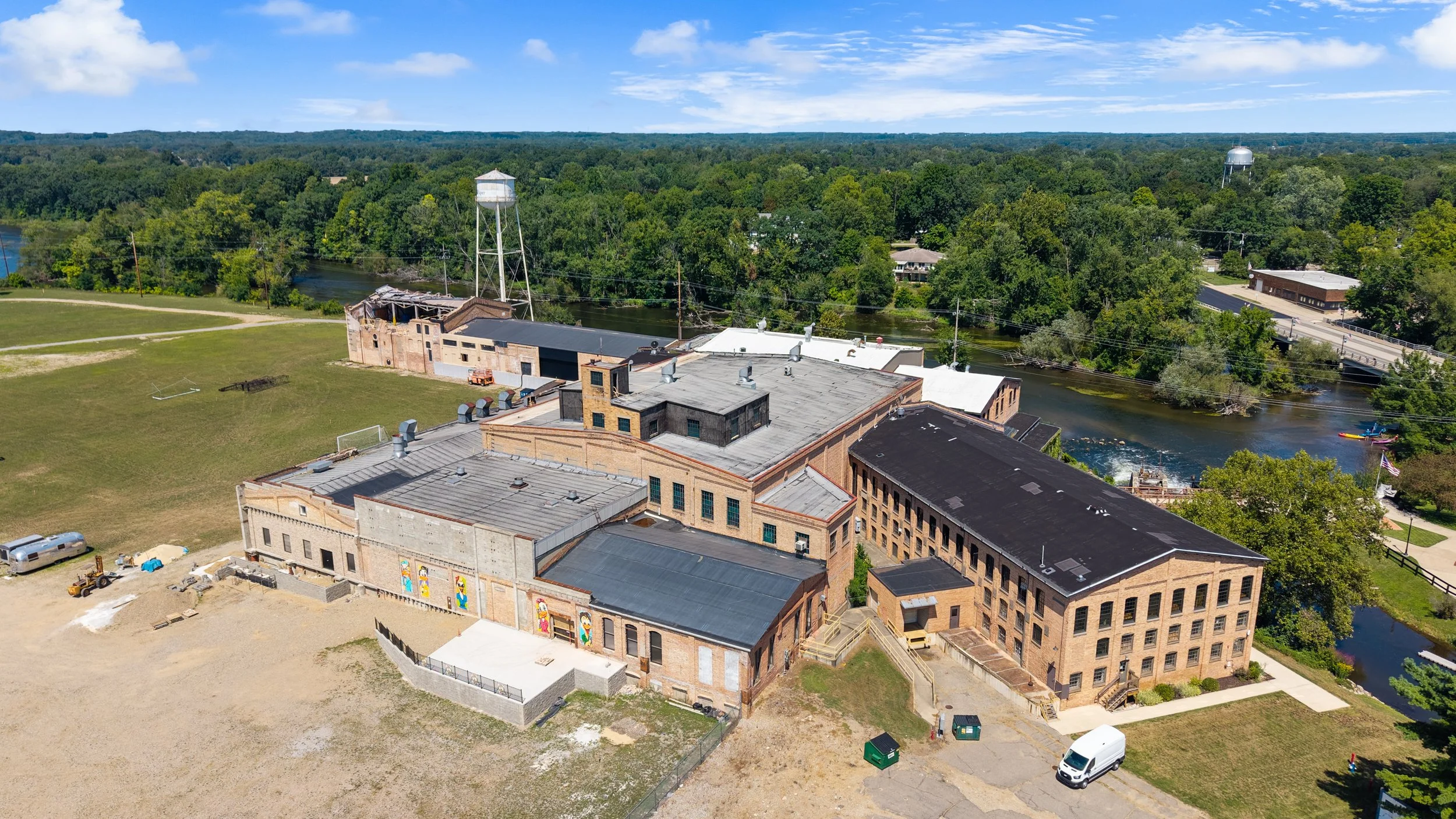
Document a historic structure without touching it.
HISTORIC PRESERVATION
Drone and 3D laser scanning documentation for historic buildings and preservation projects, providing a non-invasive way to capture a structure's exact existing condition without scaffolding or physical access to fragile areas.
-
FAA Part 107 Licensed
Fully insured drone operations
-
Southwest Michigan Based
Working across the Midwest and nationwide
-
Non-Invasive Documentation
No scaffolding or physical contact required
-
Millimeter-Accurate Scanning
3D laser scanning for exact existing conditions
Historic structures need documentation that respects their condition, with no scaffolding or physical contact with fragile facades or rooflines. Drone photography and thermal imaging reach the areas a ladder can't, and 3D laser scanning captures an exact, measurable record of a structure's current condition for preservation planning, restoration work, or a grant or historic-designation application.
WHAT WE OFFER
Built for preservation-sensitive documentation.
3D Laser Scanning & Existing-Conditions Documentation
Millimeter-accurate point cloud data of a historic structure's exact current condition, useful for restoration planning without physical contact.
Drone Thermal Roof & Facade Inspections
Identify roof moisture and facade issues on a historic structure without scaffolding or physical access.
As-Built Documentation & Floor Plans
Accurate documentation of a historic building's current layout, useful when original drawings don't exist or don't match reality.
Aerial & Detail Photography
High-resolution photography of rooflines, cupolas, and architectural details from angles a ladder can't safely reach.
Before & After Restoration Documentation
Comparable imagery captured before and after restoration work, useful for the project record and any grant reporting.
Matterport Virtual Tours
A walkable 3D record of a historic interior, useful for documentation, planning, or public interest and fundraising.
Frequently Asked Questions
-
Yes. A point cloud, measured drawings and dated photos give a grant or designation application a clear record of the building's current condition. Tell us what the program asks for and we'll deliver to match.
-
Yes, that's part of the value. Drone documentation doesn't require any physical contact with the structure, unlike scaffolding or a ladder.
-
3D laser scanning produces millimeter-accurate point cloud data, which restoration architects and contractors can use for precise planning.
-
Yes, we're glad to work directly with preservation architects, historical societies, and building owners.
-
Yes, reach out with the current site conditions and we'll let you know what's possible.
Get an exact record of your historic structure, without touching it.
Request A Quote
Tell us about your project. Our average response time is about 4 minutes during business hours.