
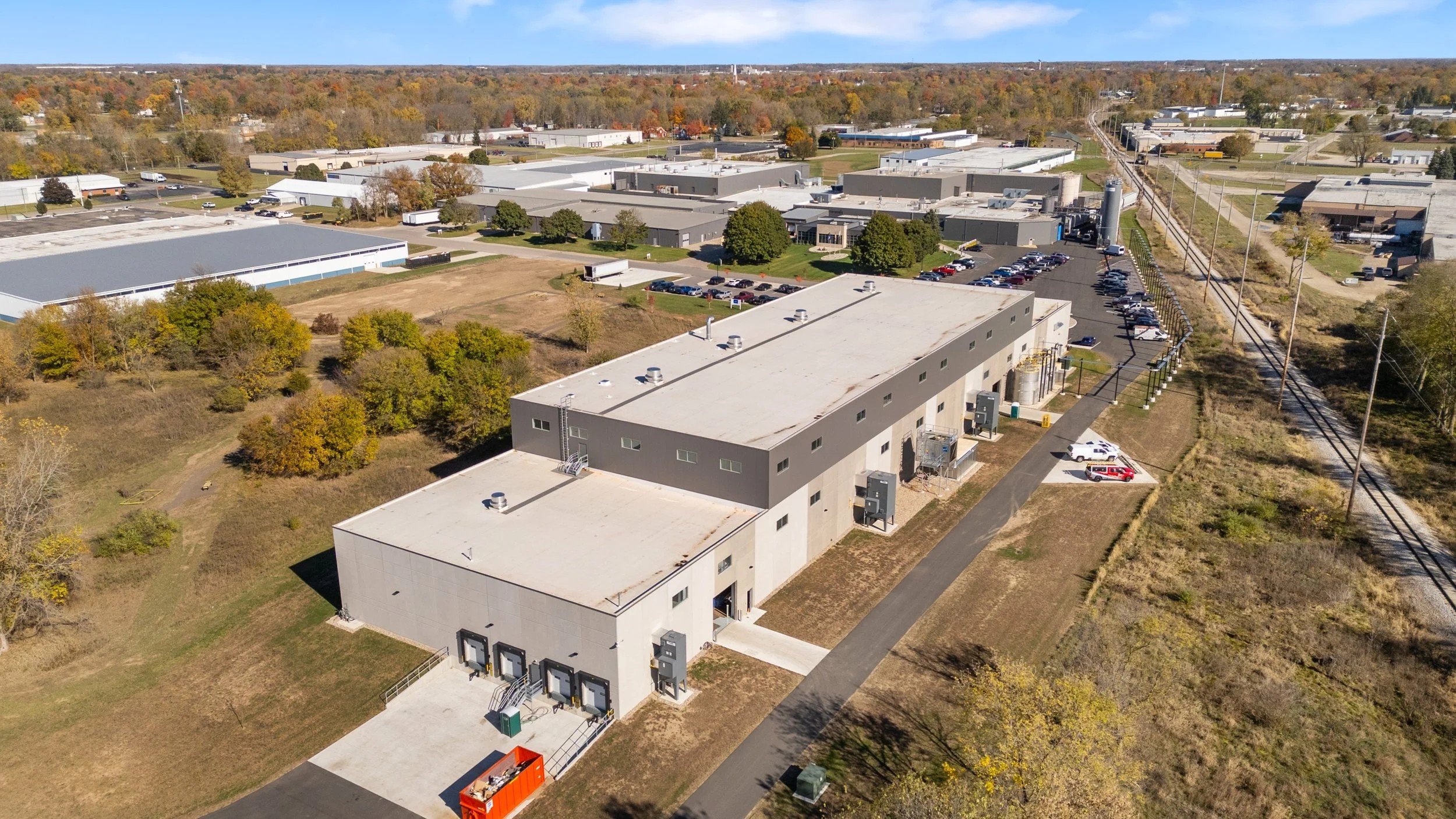
Know the building before you visit it.
We document commercial and industrial sites so owners, investors and site selectors can evaluate a property from anywhere and move faster on a decision.
-
Within 1 week
Delivered in one shareable link
-
Nationwide
Based in southwest Michigan
-
Five services
Pick any combination
-
Part 107
Certified & insured
Site selection often means deciding on a building you can’t walk. Economic development teams, site selectors and out-of-state investors need to see access, condition and layout before anyone books a trip. We document commercial and industrial sites so your team can evaluate a property from anywhere and move faster. For economic development teams, that also means a current inventory of available sites and buildings you can share with prospects, and a reliable record of existing buildings in the areas you’re trying to develop. We’re based in southwest Michigan and work nationwide.
WHAT WE DOCUMENT
Five ways to know a site before you visit
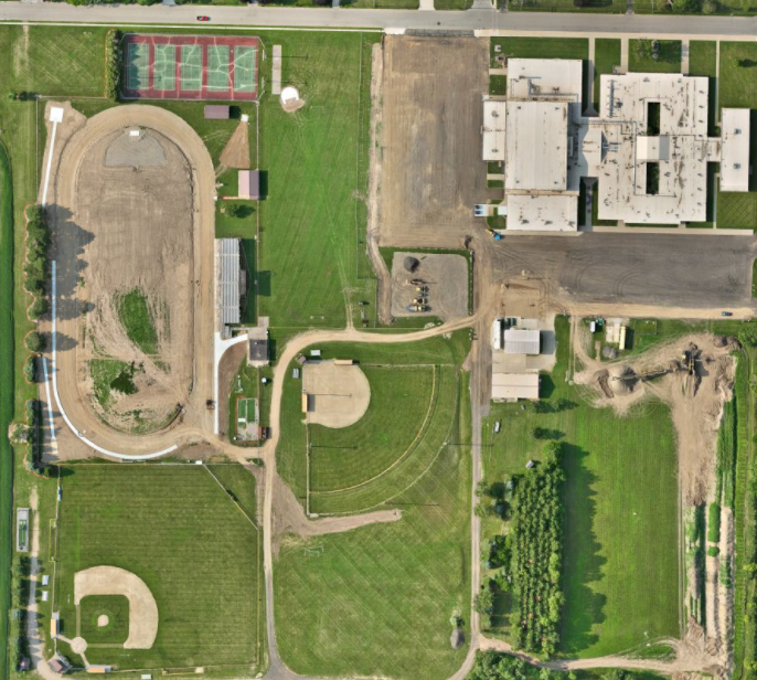
Site documentation
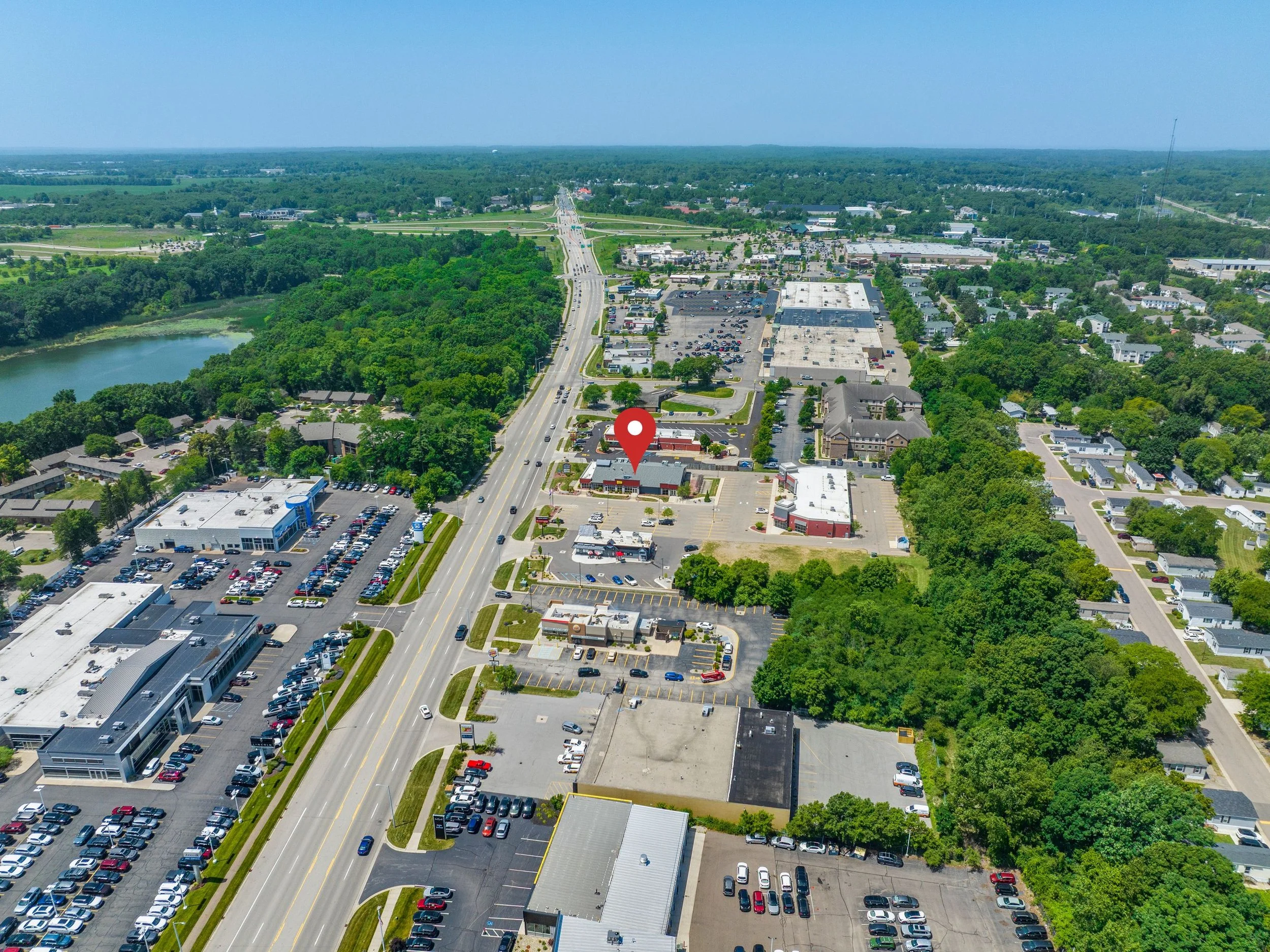
What you get: Aerial photo and video, a measurable orthomap with elevation data, and ground-level photography of the site and building.
Why it matters: It shows access, drainage, expansion room, parking and surrounding context without a trip.
Drone photography · Building photography · Drone mapping and LiDAR

Remote tour
What you get: A Matterport 3D virtual tour you can share by link, with measurements built in and a dollhouse view of the whole space.
Why it matters: Investors and decision-makers can tour a property together and save a trip, and your team can send the same link to a prospect.
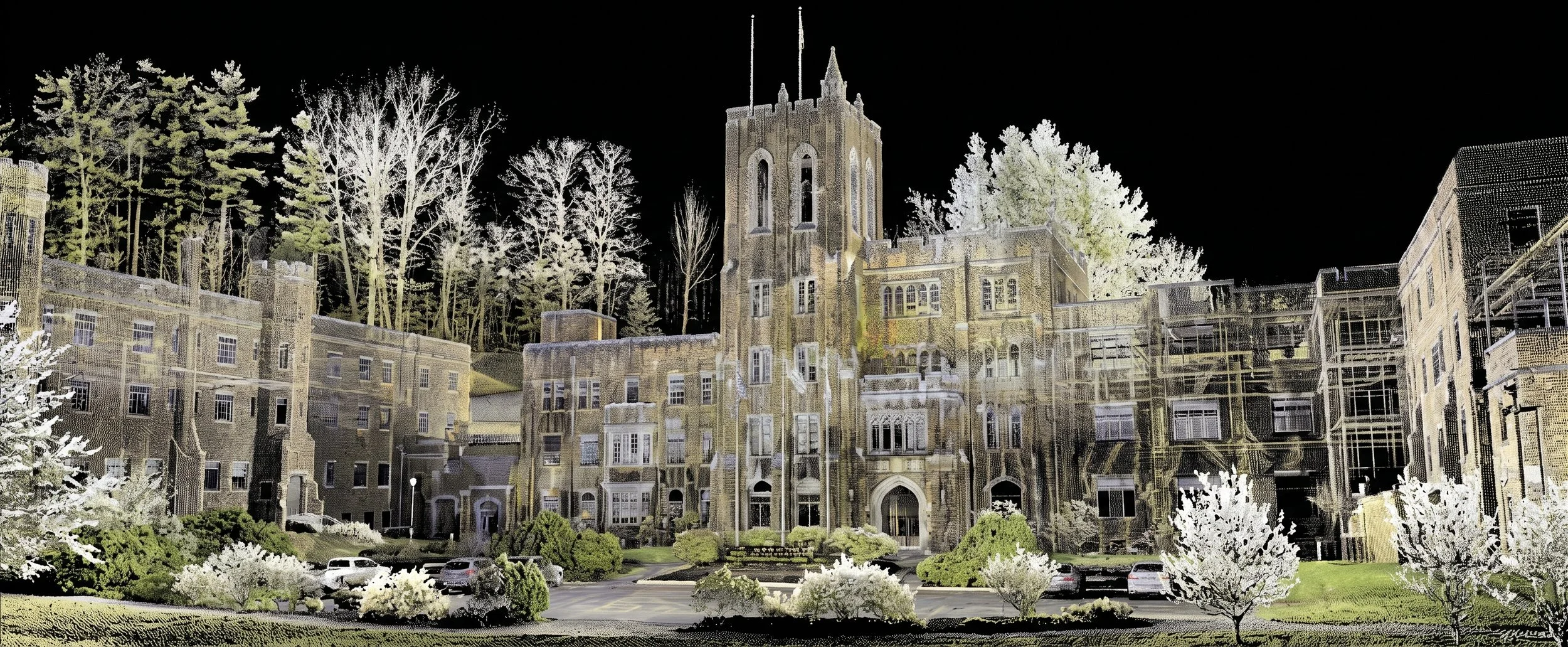
Existing conditions data
What you get: Accurate 3D laser scan data of the building as it stands today, delivered as a measurable point cloud.
Why it matters: It replaces assumptions with measurements before design, pricing or negotiation.
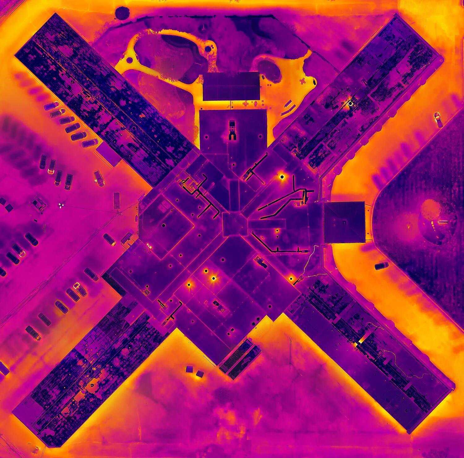
Roof reports
What you get: A thermal roof scan and report that identifies moisture and problem areas, with side-by-side thermal and visual imagery.
Why it matters: The roof is often the biggest hidden cost in an older building, and this surfaces it before closing or marketing a site.
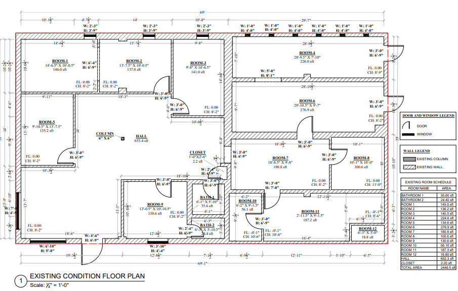
As-builts and floor plans
What you get: Current, accurate floor plans and as-builts of the building as it exists today, delivered as PDF and CAD-ready files.
Why it matters: Architects, brokers and buyers can test layouts and renovation ideas without a site visit.
FOR ECONOMIC DEVELOPMENT TEAMS
Show prospects a site before they travel.
Economic development teams can document available sites and buildings as a current inventory to share with prospects, and keep a reliable record of existing buildings in the areas they’re trying to develop. One link gives a prospect the aerials, the tour, the roof report and the floor plans, so they can shortlist a site before anyone books a trip.
WHAT A SITE PACKAGE INCLUDES
Pick any combination of the five.
You don’t need the full set if your team only needs part of it.
Site documentation: aerial photo and video, an orthomap with elevation data, and ground-level photography
A Matterport 3D virtual tour with measurements, shared by link
Existing-conditions data from 3D laser scanning, delivered as a measurable point cloud
A thermal roof scan and report
Current as-builts and updated floor plans
Tell us the site and what you need to decide. We’ll scope the mix that fits.
WHO THIS HELPS
Built for teams deciding on sites remotely
Economic development teams
Document available sites and buildings as a current inventory you can share with prospects.
Site selectors
Evaluate commercial and industrial properties remotely, with site context, measurements and condition data in one place.
Out-of-state investors
Tour a building, review the roof and see accurate existing conditions before you travel.
Brokers
Share a complete, current picture of a listing or candidate site with buyers and tenants who aren't local.
Municipalities
Keep documentation of public and privately held buildings current for planning, marketing and redevelopment.
HOW IT WORKS
From the address to a shareable link
Tell us the site
Share the address and what you need, even if you're not sure which combination is right. We'll confirm scope, access and timing.
We document it
We capture the site and building to the agreed scope, then process the photos, maps, tour, scan data and reports.
You receive one shareable link
Everything is delivered within 1 week, organized and ready to forward to a prospect, investor or internal team.
Frequently Asked Questions
You can choose any combination of the five parts: site documentation, a Matterport 3D virtual tour, 3D laser scan data of existing conditions, a thermal roof report, and as-built floor plans. Tell us the site and what your team needs to decide, and we will scope the right mix.
You receive everything in one shareable link, delivered within 1 week. If a site is unusually large or a deliverable needs a longer timeline, we will confirm that with your quote.
Yes. We are based in southwest Michigan and document commercial and industrial sites across Michigan and nationwide. Economic development teams, site selectors, brokers, and municipalities hire us to document available sites and existing buildings.
A Matterport 3D virtual tour is a photo-real, navigable 3D model of the building that you can share with a single link. Decision-makers can walk the space together from anywhere, see a dollhouse view, and take measurements without a site visit.
Yes. Commercial drone work is flown under FAA Part 107, and we carry insurance, with certificates of insurance available on request.
Request A Quote
Tell us about the site. We’ll follow up during business hours with a written quote and timeline.